Assignment 3

|
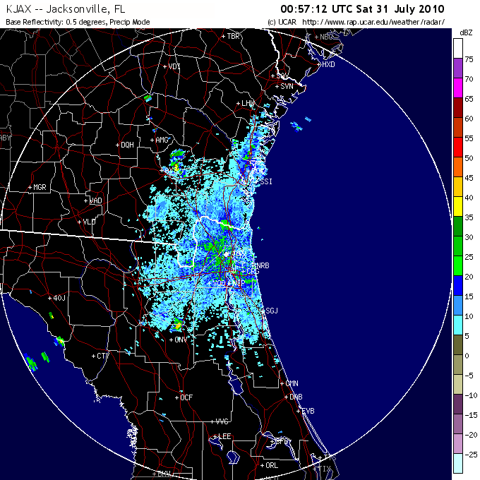
Dopplar Radar.png Size : 0.065 Kb Type : png |
|
|
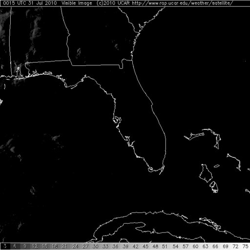
Visible Image.jpg Size : 0.026 Kb Type : jpg |
|
|
2010073100_500oa_naconf.gif Size : 0.038 Kb Type : gif |
|
|
48 hour map.jpg Size : 0.182 Kb Type : jpg |
Severe Thunderstorms Assignment
1. Tornados develop from association of super cells. It is linked to severe thunderstorms and is developed into mesocyclones. The mesocyclone formation depends on the presence of vertical wind shear. Moving upward from the surface, winds change direction form southerly to westerly as the speed increases. The wind shear that is stronger produces a rolling motion that moves on its horizontal axis. These are most often associated with a cold front or squall line of a middle-latitude cyclone.
Severe thunderstorms develop into three stages, the cumulus stage, in which updrafts dominate throughout the cloud, and growth from a cumulus to a cumulonimbus cloud occurs. The second is the mature stage, the most intense phase, with heavy rain and possibly small hail, in which downdrafts are found side by side with updrafts. The third is the dissipating stage, dominated by downdrafts and entrapment, causing evaporation of the structure.
Hail is produced by only in large cumulonimbus clouds where updrafts can sometimes reach the speeds approaching 100 miles per hour where there is an abundant supply of super cooled water.
2. It was really neat to see all the images and see them line up correctly as to what the weather is doing. In the In Visible image shows white clouds that look like cumulonimbus clouds, these clouds carry heavy precipitation.
The radar is very helpful and corresponds with the visible image because it has a significant ability to track thunderstorms and their potential to produce tornados. The radar shows the mesocyclones forming and can detect the wind speeds that give you the information as to what kind of storm is actually forming. In this radar image, it shows the wind speeds/rain from 20dBZ up to 60dBZ. The 20 in some areas is moderate rain fall in some areas of yellow, orange and red it is very heavy. This also corresponds to the SPC. You can tell in all three images that there is very fast storms approaching and with the Doppler, visible, and SPC watch; you know there is a major mesocyclones forming.
3. While doing this assignment it has made me pay attention to the weather more closely. I appreciate all the science and research that is involved to keep the public safe and informed. I find it amazing all that goes into place when you compile all this information and determining which mesocyclone is brewing as in how severe it is, etc. I really liked looking at all the infrared and visible images. I’ve always loved space and learning about what goes on up there and how it affects us down here on Earth. Everyday, I was looking at the watches and determining which one would be a good one to use. When I saw these images, I knew that I was going to get valuable information to help me understand the cycles of a mesocyclone and determining from all the data, the actual storm evolving.
